24th Mountain Forest Course 1st Field Aranyacala Nature Lovers Students
The course is one of the activities organized by Aranyacala Nature Lovers Students. Currently, Aranyacala manages six active courses, including Mountain Forest Course, River Rafting Course, Rock Climbing Course, Paragliding Course, Maritime Course, and Cave Exploration Course. Currently, the author is participating in the Mountain Forest Course as one of the official requirements to become a full membership of Aranyacala.
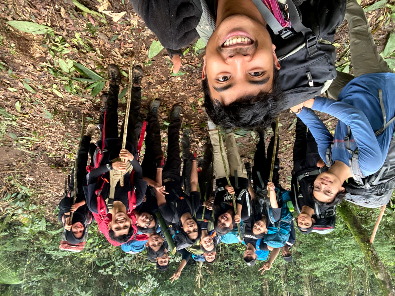
In the Mountain Forest Course, there are several class meetings to discuss materials and field activities four times. Currently, the author is participating in the first field activity after attending advanced Land Navigation classes that cover Route Card and Route Planning. In this field activity, the author implements the materials taught in class directly.
Mount Luhur & Mount Kencana
Training is conducted on Mount Luhur and Mount Kencana, where this Field 1 training follows a route based on the previously created Map and Route Card. The instructor also teaches the author to perform terrain orientation, determine the observer’s position (Resection), and identify object positions such as the peak of Mount Kencana (Intersection). Additionally, the instructor teaches the author to navigate in a closed environment, where explorers rely solely on the Map and Route Card for climbing and exploration in enclosed surroundings.
The Map and Route Card include five peak points, with three of them being the highest peaks in the surrounding area, namely Rimba Peak, Luhur Peak, and Kencana Peak. The natural atmosphere in the surrounding area is quite beautiful and has the ambiance of a tropical rainforest. Along the way, there are also several points suitable for setting up camps.
The journey begins by taking public transportation to Ciawi and then using a travel service to reach the entrance gate to Telaga Warna at the summit. Then, we walk along the Telaga Warna route, passing through a village at the foot of Mount Luhur, where there is a tea plantation ambiance along the way. Before entering the vegetation boundary, there is a small river with relatively clean water. Before continuing the journey, we replenish our water supply because there is no water source along the climbing and training route. The journey continues, and we start entering the vegetation boundary at the foot of Mount Luhur, Rimba Peak. We set up camp on a saddle (a hill flanked by two mountains) before continuing the climb the next day.
In the morning, we prepare breakfast and continue the journey by climbing to Rimba Peak. Along the journey, the path we take has a fairly narrow ridge, and we must be cautious during the climb because there are steep cliffs on both sides. Upon reaching Rimba Peak, we take a short break and continue the journey.
Next, we continue the journey to Luhur Peak, but we got lost due to rain and thick fog, and our understanding of closed navigation was insufficient. After being guided by the instructor, we continued the journey to the correct route towards the summit of Mount Luhur. Upon reaching the summit, the sun had started to set, indicating that we needed to set up camp. We set up camp at the foot of Mount Luhur and continued the journey the next day.
Survival Food
Along the way, we found edible survival plants, namely begonia. We cut and ate begonia as a snack during this climbing training. Upon reaching Kencana Peak, our fatigue was rewarded with a beautiful view from the top of Mount Kencana.
Photo by Aranyacala on Instagram
The journey continues through the western side of Mount Kencana, where we pass through a very steep valley path. This path is quite dangerous because it seems there was a landslide before, making the climbing route steeper. Many of our friends slipped and even fell when descending, but fortunately, we all managed to descend safely. Upon reaching the bottom, we climbed back to the ridge to pass through the intended route. Due to the landslide, we got a little lost because the passed route disappeared, but thankfully, we managed to find the path. And after we exited the forest vegetation boundary and found a tea plantation, we could breathe a sigh of relief.
- Kencana Mount
- Begonia Survival Food
- Bogor
The journey continues to the village, and we walk home towards the main road to get transportation back to Puncak highway.
Baktiku, Akhir - Akhirnya | My Service, Finally